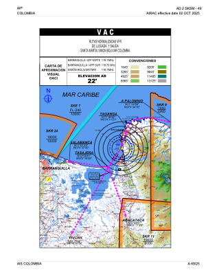
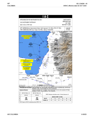
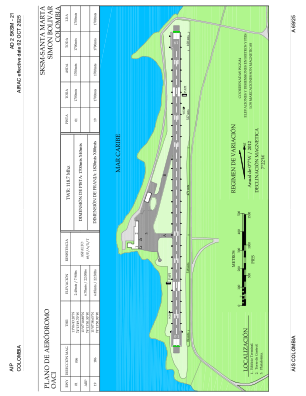


SKSM - Santa Marta-Simon Bolivar
Located in Santa Marta, Colombia
ICAO - SKSM, IATA - SMR
Data provided by AirmateGeneral information
Coordinates: N11°7'11" W74°13'50"
Elevation is 22 feet MSL.
Magnetic variation is -9° East View others Airports in Magdalena
Operational data
Special qualification required
Current time UTC:
Current local time:
Weather
METAR: SKSM 060900Z AUTO VRB02KT CAVOK 28/23 Q1008
TAF: TAF SKSM 060430Z 0606/0706 VRB03KT 9999 FEW020 BECMG 0617/0619 01012KT TX34/0619Z TN26/0610Z
Communications frequencies: [VIEW]
Runways:
| RWY identifier | QFU | Length (ft) | Width (ft) | Surface | LDA (ft) |
| 01 | 359° | 5577 | 131 | ASPH | 5577 |
| 19 | 179° | 5577 | 131 | ASPH | 5577 |
Airport contact information
Address: Santa Marta Colombia