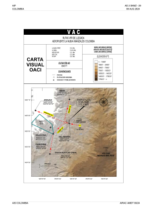


SKMZ - Manizales-La Nubia
Located in Manizales, Colombia
ICAO - SKMZ, IATA - MZL
Data provided by AirmateGeneral information
Coordinates: N5°1'48" W75°27'56"
Elevation is 6860 feet MSL.
Magnetic variation is -7° East View others Airports in Caldas
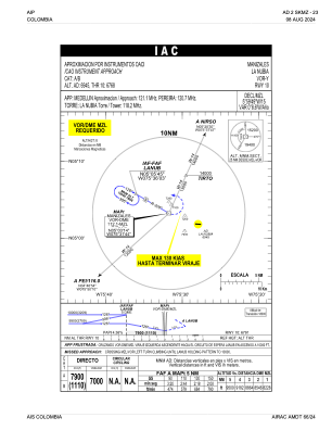
Operational data
Special qualification required
Current time UTC:
Current local time:
Weather at : SKPE - Pereira-Matecana ( 39 km )
METAR: SKPE 071100Z 13006KT 9999 MIFG SCT016 SCT080 20/18 Q1016
Communications frequencies: [VIEW]
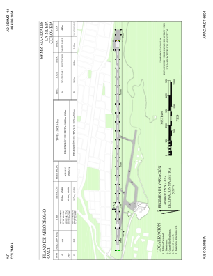
Runways:
| RWY identifier | QFU | Length (ft) | Width (ft) | Surface | LDA (ft) |
| 10 | 95° | 4593 | 49 | ASPH | 4593 |
| 28 | 275° | 4593 | 49 | ASPH |
Airport contact information
Address: Manizales Colombia