


RPLP - Legazpi Principal Airport (Class 1)
Located in Legazpi City, Philippines
ICAO - RPLP, IATA - LGP
Data provided by AirmateGeneral information
Coordinates: N13°9'26" E123°44'4"
Elevation is 59 feet MSL.
Magnetic variation is -2° East View others Airports in Albay
Operational data
Special qualification required
Current time UTC:
Current local time:
Communications frequencies: [VIEW]
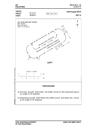
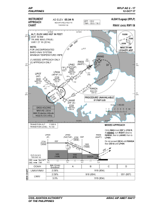
Runways:
| RWY identifier | QFU | Length (ft) | Width (ft) | Surface | LDA (ft) |
| 06 | 57° | 6867 | 118 | ASPH | 6211 |
| 24 | 237° | 6867 | 118 | ASPH | 6496 |
Airport contact information
Address: Legazpi City Philippines