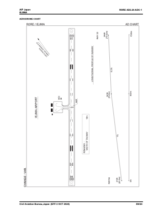


RORE - Iejima
Located in , Japan
ICAO - RORE, IATA - IEJ
Data provided by AirmateGeneral information
Coordinates: N26°43'21" E127°47'13"
Elevation is 238 feet MSL.
View others Airports in Okinawa Prefecture
Operational data
Special qualification required
Current time UTC:
Current local time:
Communications frequencies: [VIEW]
Runways:
| RWY identifier | QFU | Length (ft) | Width (ft) | Surface | LDA (ft) |
| 04 | 39° | 4920 | 150 | ASP | |
| 22 | 219° | 4920 | 150 | ASP |
Airport contact information
Address: Japan