


RJSF - Fukushima
Located in Koriyama, Japan
ICAO - RJSF, IATA - FKS
Data provided by AirmateGeneral information
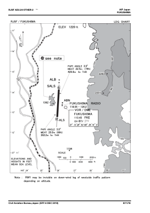
Coordinates: N37°13'39" E140°25'41"
Elevation is 1220 feet MSL.
View others Airports in Fukusima Prefecture
Operational data
Special qualification required
Current time UTC:
Current local time:
Weather
METAR: RJSF 270500Z VRB04KT 9999 FEW025 SCT120 BKN/// 23/14 Q1010
TAF: TAF RJSF 270514Z 2706/2812 14006KT 9999 FEW030 SCT060 BECMG 2714/2716 36008KT
Communications frequencies: [VIEW]
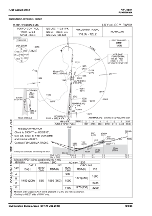
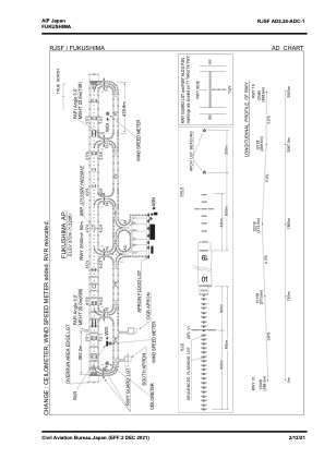
Runways:
| RWY identifier | QFU | Length (ft) | Width (ft) | Surface | LDA (ft) |
| 01 | 2° | 8202 | 197 | ASP | |
| 19 | 182° | 8202 | 197 | ASP |
Airport contact information
Address: Koriyama Japan