


RJCN - Nakashibetsu
Located in Nakashibetsu, Japan
ICAO - RJCN, IATA - SHB
Data provided by AirmateGeneral information
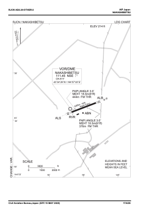
Coordinates: N43°34'39" E144°57'36"
Elevation is 214 feet MSL.
View others Airports in Hokkaido Prefecture
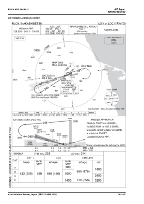
Operational data
Special qualification required
Current time UTC:
Current local time:
Weather
METAR: RJCN 280100Z 05005KT 340V080 CAVOK 18/09 Q1008
Communications frequencies: [VIEW]
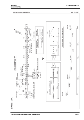
Runways:
| RWY identifier | QFU | Length (ft) | Width (ft) | Surface | LDA (ft) |
| 08 | 71° | 6562 | 148 | ASP | |
| 26 | 251° | 6562 | 148 | ASP |
Airport contact information
Address: Nakashibetsu Japan