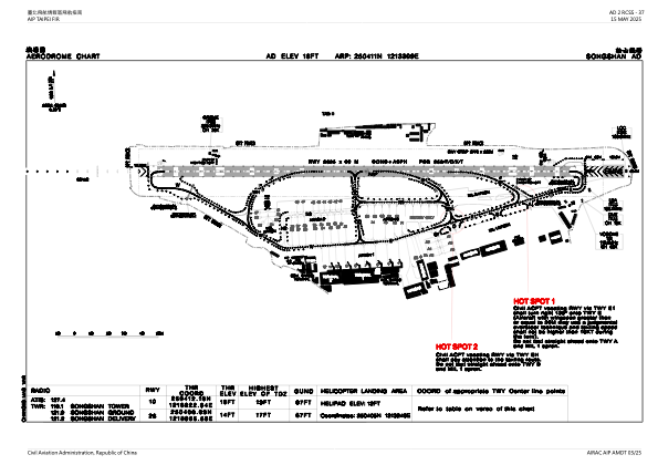


RCSS - Taipei/Songshan
Located in Taipei, Taiwan, Province of China
ICAO - RCSS, IATA - TSA
Data provided by AirmateGeneral information
Coordinates: N25°4'11" E121°33'9"
Elevation is 18 feet MSL.
View others Airports in Taipei (municipality)
Operational data
Special qualification required
Current time UTC:
Current local time:
Weather
METAR: RCSS 292300Z 09005KT 9999 FEW025 27/24 Q1006 NOSIG RMK A2971
TAF: TAF RCSS 292300Z 3000/3024 27005KT 9999 FEW015 BKN032 TEMPO 3004/3010 26012KT TEMPO 3012/3018 3200 SHRA FEW008 FEW012CB BKN014 TEMPO 3018/3024 08005KT 5000 SHRA FEW008 FEW012CB BKN018
Communications frequencies: [VIEW]
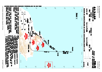
Runways:
| RWY identifier | QFU | Length (ft) | Width (ft) | Surface | LDA (ft) |
| 10 | 92° | 8547 | 197 | ASP | |
| 28 | 272° | 8547 | 197 | ASP |
Airport contact information
Address: Taipei Taiwan, Province of China