


PTPN - Pohnpei Intl
Situé à Pohnpei Island, Micronesia, Federated States of
ICAO - PNI, IATA - PNI
Données fournies par AirmateInformation générale
Coordonnées: N6°59'6" E158°12'35"
Élévation : 8 feet MSL.
Variation magnétique : +7° East Voir autres Aéroports à Pohnpei
Données opérationnelles
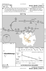
Special qualification required
Heure actuelle UTC:
Heure actuelle locale:
Météo
TAF: PTPN 111138Z 1112/1212 07009KT P6SM VCSH SCT017 BKN130 TEMPO 1112/1116 VRB10G20KT 4SM -SHRA BKN017
Fréquences de communication: [VIEW]
Pistes:
| Identifiant RWY | QFU | Longueur (ft) | Largeur (ft) | Surface | LDA (ft) |
| 09 | 90° | 6600 | 150 | ASPH | |
| 27 | 270° | 6600 | 150 | ASPH |
Coordonnées de l'aéroport
Adresse: Pohnpei Island Micronesia, Federated States of