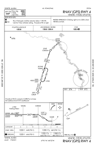


PAVE - Venetie
Located in Venetie,
ICAO - VEE, IATA - VEE
Data provided by AirmateGeneral information
Coordinates: N67°0'31" W146°21'59"
Elevation is 574 feet MSL.
Magnetic variation is 18° East View others Airports in Alaska
Operational data
Special qualification required
Current time UTC:
Current local time:
Weather at : PFYU - Fort Yukon ( 69 km )
METAR: PFYU 022356Z 08005KT 10SM SCT046 BKN055 OVC080 M01/M11 A3020 RMK AO2 SLP244 T10061111 11006 21067 58013
Communications frequencies: [VIEW]
Runways:
| RWY identifier | QFU | Length (ft) | Width (ft) | Surface | LDA (ft) |
| 04 | 62° | 4000 | 75 | GRAVEL | |
| 22 | 242° | 4000 | 75 | GRAVEL |
Airport contact information
Address: Venetie