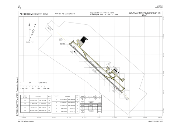


ORSU - Sulaymaniyah International Airport
Located in Sulaymaniyah, Iraq
ICAO - ORSU, IATA - ISU
Data provided by AirmateGeneral information
Coordinates: N35°33'38" E45°18'52"
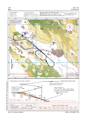
Elevation is 2492 feet MSL.
View others Airports in As-Sulaymaniyyah Governorate
Operational data
Special qualification required
Current time UTC:
Current local time:
Weather
METAR: ORSU 060100Z 11007KT 9999 BKN040 BKN070 16/11 Q1012
TAF: TAF ORSU 052300Z 0600/0624 08008KT 9999 SCT040 BKN070 TEMPO 0604/0606 -RA BKN040 BKN070 BECMG 0606/0608 14012KT 5000 RA BKN040 BKN070 TEMPO 0607/0614 -TSRA FEW035CB BKN040 BKN070 BECMG 0614/0616 20008KT 9999 NSW
Communications frequencies: [VIEW]
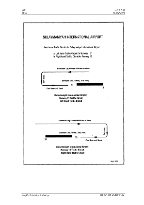
Runways:
| RWY identifier | QFU | Length (ft) | Width (ft) | Surface | LDA (ft) |
| 13 | 133° | 11483 | 148 | CON | |
| 31 | 313° | 11483 | 148 | CON |
Airport contact information
Address: Sulaymaniyah Iraq