


ORMM - Basrah International Airport
Located in Basrah, Iraq
ICAO - ORMM, IATA - BSR
Data provided by AirmateGeneral information
Coordinates: N30°32'56" E47°39'43"
Elevation is 11 feet MSL.
View others Airports in Basra Governorate
Operational data
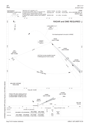
Special qualification required
Current time UTC:
Current local time:
Weather
METAR: ORMM 031100Z 14022KT 9999 SCT035 34/19 Q0999 NOSIG
TAF: TAF ORMM 031000Z 0312/0412 15015G25KT 9999 SCT035 PROB40 0312/0318 FEW035 BKN100 PROB40 TEMPO 0312/0318 7000 RA PROB30 TEMPO 0312/0319 5000 TSRA FEW030CB BECMG 0319/0322 14005KT 9999 FEW035
Communications frequencies: [VIEW]
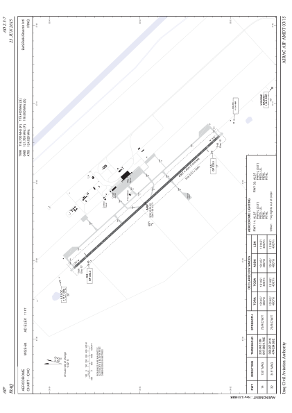
Runways:
| RWY identifier | QFU | Length (ft) | Width (ft) | Surface | LDA (ft) |
| 14 | 138° | 13146 | 148 | CON | |
| 32 | 318° | 13146 | 148 | CON |
Airport contact information
Address: Basrah Iraq