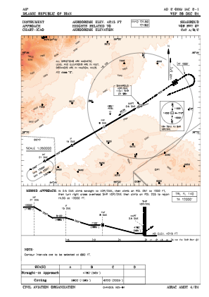
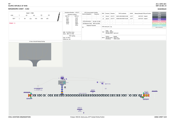


OIMJ - Shahroud / National
Located in Shahroud, Iran, Islamic Republic of
ICAO - OIMJ, IATA - RUD
Data provided by AirmateGeneral information
Coordinates: N36°25'31" E55°6'15"
Elevation is 4214 feet MSL.
View others Airports in Semnan Province
Operational data
Special qualification required
Current time UTC:
Current local time:
Weather at : - ( 0 km )
METAR: ZMCK 021030Z 23009MPS 9999 FEW033 24/M07 Q1005 NOSIG RMK QFE639.6 12 MOP
Communications frequencies: [VIEW]
Runways:
| RWY identifier | QFU | Length (ft) | Width (ft) | Surface | LDA (ft) |
| 07 | 70° | 9977 | 148 | ASP | |
| 25 | 250° | 9977 | 148 | ASP |
Airport contact information
Address: Shahroud Iran, Islamic Republic of