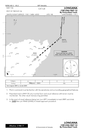
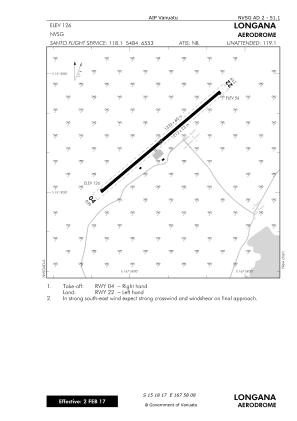


NVSG - Longana
Located in , Vanuatu
ICAO - NVSG, IATA - LOD
Data provided by AirmateGeneral information
Coordinates: S15°18'17" E167°58'8"
Elevation is 126 feet MSL.
View others Airports in Penama
Operational data
Special qualification required
Current time UTC:
Current local time:
Weather
TAF: TAF NVSG 271700Z 2718/2818 13005KT 9999 SCT020 BKN040 INTER 2720/2724 9000 SHRA FEW010 BKN018 OVC038 PROB40 INTER 2718/2720 7000 -TSRA FEW008 BKN018 FEW022CB OVC090
Communications frequencies: [VIEW]
Runways:
| RWY identifier | QFU | Length (ft) | Width (ft) | Surface | LDA (ft) |
| 04 | 0° | 3976 | 75 | Grass | |
| 22 | 0° | 3976 | 75 | Grass |
Airport contact information
Address: Vanuatu