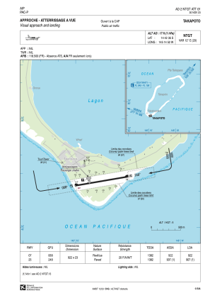
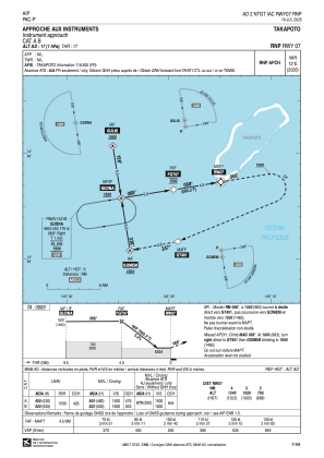
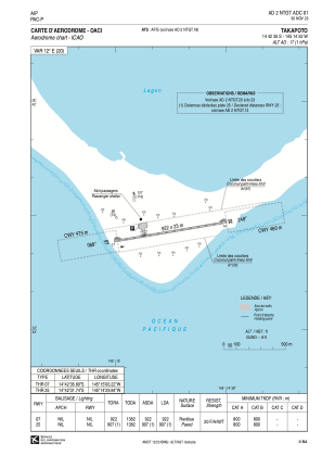


NTGT - Takapoto
Located in Fakatopatere, French Polynesia
ICAO - NTGT, IATA - TKP
Data provided by AirmateGeneral information
Coordinates: S14°42'35" W145°14'52"
Elevation is 17 feet MSL.
Magnetic variation is 12.11° East View others Airports in (unassigned)
Operational data
Special qualification required
Current time UTC:
Current local time:
Weather at : - ( 0 km )
METAR: MUGM 0225#Z 34010KT 8SM -RA FEW020 BKN060 BKN090 24/23 A2983 RMK AO2 RAE26B48 SLP102 P01 T02390228 $
Communications frequencies: [VIEW]
Runways:
| RWY identifier | QFU | Length (ft) | Width (ft) | Surface | LDA (ft) |
| 07 | 80° | 3025 | 75 | ASPH | 3025 |
| 25 | 260° | 3025 | 75 | ASPH | 2976 |
Airport contact information
Address: Fakatopatere French Polynesia