


NSFA - Faleolo
Located in Apia, Samoa
ICAO - NSFA, IATA - APW
Data provided by AirmateGeneral information
Coordinates: S13°49'55" W171°59'53"
Elevation is 58 feet MSL.
View others Airports in A'ana District
Operational data
Special qualification required
Current time UTC:
Current local time:
Weather
METAR: NSFA 281900Z 10004KT 9999 SCT024 29/24 Q1010
TAF: TAF NSFA 281717Z 2818/2918 12005KT 9999 FEW025
Communications frequencies: [VIEW]
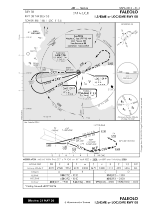
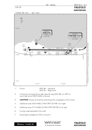
Runways:
| RWY identifier | QFU | Length (ft) | Width (ft) | Surface | LDA (ft) |
| 08 | 89° | 9843 | 148 | BITUM | |
| 26 | 269° | 9843 | 148 | BITUM |
Airport contact information
Address: Apia Samoa