


NCAI - Aitutaki
Located in Aitutaki Island, Cook Islands
ICAO - NCAI, IATA - AIT
Data provided by AirmateGeneral information
Coordinates: S18°49'52" W159°45'50"
Elevation is 19 feet MSL.
View others Airports in (unassigned)
Operational data
Special qualification required
Current time UTC:
Current local time:
Weather
METAR: NCAI 290600Z AUTO 10016KT //// ////// 26/21 Q1013
Communications frequencies: [VIEW]
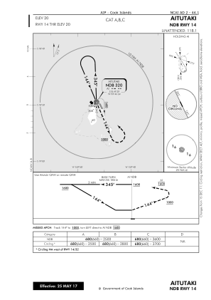
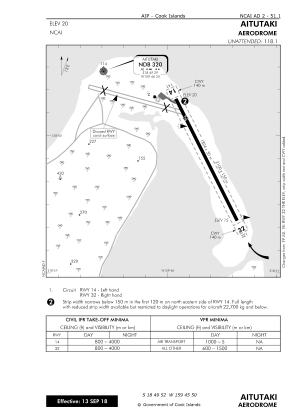
Runways:
| RWY identifier | QFU | Length (ft) | Width (ft) | Surface | LDA (ft) |
| 14 | 154° | 5984 | 98 | BITUM | 5984 |
| 32 | 334° | 5984 | 98 | BITUM | 5984 |
Airport contact information
Address: Aitutaki Island Cook Islands