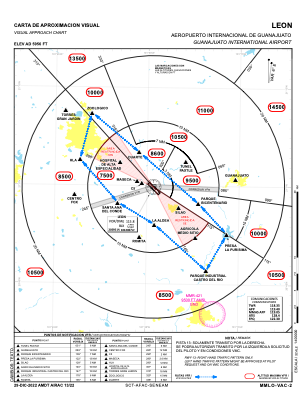
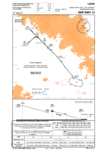
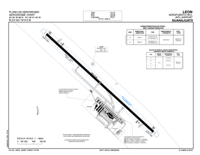


MMLO - Leon Aeropuerto Internacional De Guanajuato
Located in Leon, Mexico
ICAO - MMLO, IATA - BJX
Data provided by AirmateGeneral information
Coordinates: N20°59'36" W101°28'51"
Elevation is 5956 feet MSL.
Magnetic variation is 5° East View others Airports in Guanajuato
Operational data
Special qualification required
Current time UTC:
Current local time:
Weather
METAR: MMLO 280255Z 29006KT 8SM FEW250 24/M08 A3006 RMK SLP030 52016 957 8/001
TAF: TAF MMLO 271638Z 2718/2818 27012KT P6SM SCT250 TEMPO 2721/2801 25012G22KT SCT030 FM280200 27008KT P6SM BKN250 BECMG 2811/2813 27005KT SKC FM281600 24010KT P6SM SKC
Communications frequencies: [VIEW]
Runways:
| RWY identifier | QFU | Length (ft) | Width (ft) | Surface | LDA (ft) |
| 13 | 134° | 11486 | 148 | ASP | |
| 31 | 314° | 11486 | 148 | ASP |
Airport contact information
Address: Leon Mexico