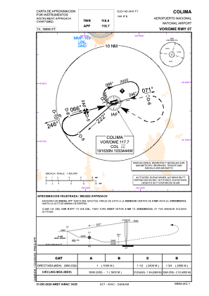
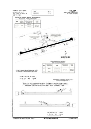


MMIA - Colima Aeropuerto Nacional
Located in Colima, Mexico
ICAO - MMIA, IATA - CLQ
Data provided by AirmateGeneral information
Coordinates: N19°16'37" W103°34'39"
Elevation is 2467 feet MSL.
View others Airports in Col ima
Operational data
Special qualification required
Current time UTC:
Current local time:
Weather
METAR: MMIA 080058Z RTD 25010KT 6SM BKN180 27/11 A2985 RMK 8/002 HZY
TAF: TAF MMIA 071646Z 0718/0818 24012KT P6SM BKN250 FM080300 00000KT P6SM BKN250
Communications frequencies: [VIEW]
Runways:
| RWY identifier | QFU | Length (ft) | Width (ft) | Surface | LDA (ft) |
| 07 | 74° | 7546 | 148 | ASP | |
| 25 | 254° | 7546 | 148 | ASP |
Airport contact information
Address: Colima Mexico