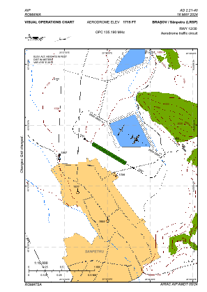
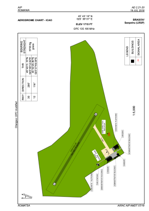


LRSP - Brasov / Sanpetru
Located in Brasov, Romania
ICAO - , IATA -
Data provided by AirmateGeneral information
Coordinates: N45°43'16" E25°38'1"
Elevation is 1715 feet MSL.
Magnetic variation is 4.55° East View others Airports in Brasov
Operational data
Special qualification required
Current time UTC:
Current local time:
Weather at : - ( 0 km )
METAR: PHNG 020204Z 06012G20KT 7SM BKN025 BKN031 28/19 A2997 RMK AO2 T02830194 $
Communications frequencies: [VIEW]
Runways:
| RWY identifier | QFU | Length (ft) | Width (ft) | Surface | LDA (ft) |
| 12 | 121° | 1969 | 59 | GRASS | 1969 |
| 30 | 301° | 1969 | 59 | GRASS | 1969 |
Airport contact information
Address: Brasov Romania