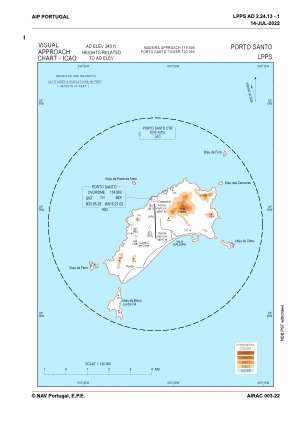
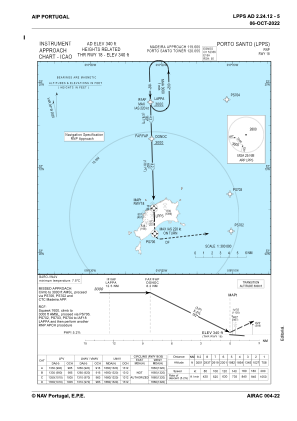
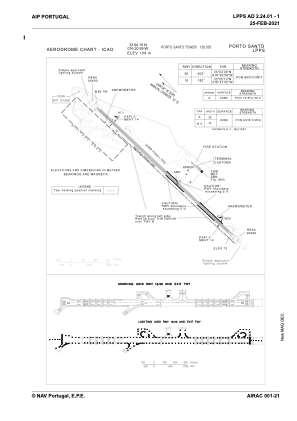


LPPS - Porto Santo
Located in Porto Santo, Portugal
ICAO - LPPS, IATA - PXO
Data provided by AirmateGeneral information
Coordinates: N33°4'15" W16°20'59"
Elevation is 339 feet MSL.
Magnetic variation is -004.3032° East View others Airports in Autonomous Region of Madeira
Operational data
Special qualification required
Current time UTC:
Current local time:
Weather
METAR: LPPS 042200Z 31004KT 9999 FEW015 19/16 Q1021
TAF: TAF LPPS 041700Z 0418/0524 30010KT 9999 FEW015 BECMG 0500/0502 VRB05KT TEMPO 0500/0509 SCT015 BKN030 BECMG 0512/0514 30008KT BECMG 0519/0521 33008KT
Communications frequencies: [VIEW]
Runways:
| RWY identifier | QFU | Length (ft) | Width (ft) | Surface | LDA (ft) |
| 18 | 178° | 9843 | 148 | CON | |
| 36 | 358° | 9843 | 148 | CON |
Airport contact information
Address: Porto Santo Portugal
