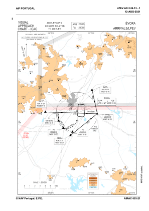
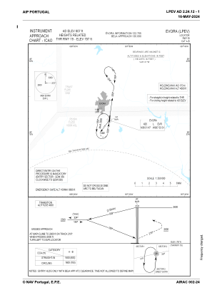
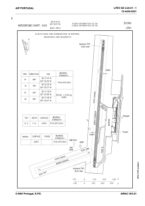


LPEV - Evora
Located in Evora, Portugal
ICAO - LPEV, IATA -
Data provided by AirmateGeneral information
Coordinates: N38°31'47" W7°53'31"
Elevation is 806 feet MSL.
Magnetic variation is -001.4405° East View others Airports in Évora District
Operational data
Special qualification required
Current time UTC:
Current local time:
Weather at : LPBJ - Beja ( 50 km )
METAR: LPBJ 290700Z 29006KT 9999 FEW010 07/07 Q1018
TAF: TAF LPBJ 290504Z 2906/3006 30010KT 9999 FEW040 BECMG 2922/2924 27005KT
Communications frequencies: [VIEW]
Runways:
| RWY identifier | QFU | Length (ft) | Width (ft) | Surface | LDA (ft) |
| 01 | 4° | 4266 | 75 | ASPH | 4085 |
| 19 | 184° | 4266 | 75 | ASPH | 4134 |
| 07 | 73° | 1739 | 98 | SAND | 1739 |
| 25 | 253° | 1739 | 98 | SAND | 1739 |
Airport contact information
Address: Evora Portugal
