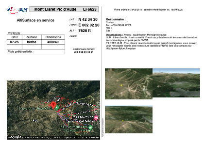


LF6623 - Mont Llaret Pic d'Aude
Located in Les Angles, France
ICAO - , IATA -
Data provided by AirmateGeneral information
Coordinates: N42°34'30" E2°2'20"
Elevation is 7628 feet MSL.
View others Airports in Languedoc-Roussillon
Operational data
Special qualification required
Current time UTC:
Current local time:
Communications frequencies: [VIEW]
Runways:
| RWY identifier | QFU | Length (ft) | Width (ft) | Surface | LDA (ft) |
| 07 | 0° | 1312 | 131 | GRASS | |
| 25 | 0° | 1312 | 131 | GRASS |
Airport contact information
Address: Les Angles France