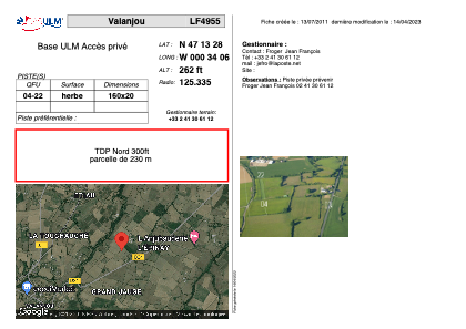


LF4955 - Valanjou
Located in Valanjou, France
ICAO - , IATA -
Data provided by AirmateGeneral information
Coordinates: N47°13'28" W0°34'6"
Elevation is 262 feet MSL.
View others Airports in Pays-de-la-Loire
Operational data
Special qualification required
Current time UTC:
Current local time:
Weather at : LFJR - Angers Marce ( 42 km )
METAR: LFJR 061830Z AUTO 25003KT 220V280 9999 FEW010/// SCT015/// BKN070/// ///CB 12/12 Q1009
Communications frequencies: [VIEW]
Runways:
| RWY identifier | QFU | Length (ft) | Width (ft) | Surface | LDA (ft) |
| 04 | 0° | 524 | 65 | GRASS | |
| 22 | 0° | 524 | 65 | GRASS |
Airport contact information
Address: Valanjou France