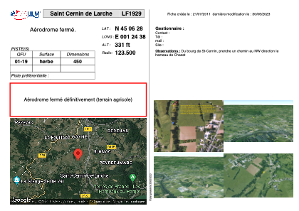


LF1929 - Saint Cernin de Larche
Located in Saint-Cernin-de-l'Arche, France
ICAO - , IATA -
Data provided by AirmateGeneral information
Coordinates: N45°6'28" E1°24'38"
Elevation is 331 feet MSL.
View others Airports in Limousin
Operational data
Special qualification required
Current time UTC:
Current local time:
Communications frequencies: [VIEW]
Runways:
Airport contact information
Address: Saint-Cernin-de-l'Arche France