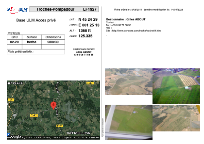


LF1927 - Troches-Pompadour
Located in Troche, France
ICAO - , IATA -
Data provided by AirmateGeneral information
Coordinates: N45°24'29" E1°25'13"
Elevation is 1368 feet MSL.
View others Airports in Limousin
Operational data
Special qualification required
Current time UTC:
Current local time:
Weather at : LFSL - Brive Souillac ( 41 km )
METAR: LFSL 030100Z AUTO 00000KT CAVOK 04/03 Q1017
Communications frequencies: [VIEW]
Runways:
| RWY identifier | QFU | Length (ft) | Width (ft) | Surface | LDA (ft) |
| 02 | 0° | 1902 | 98 | GRASS | |
| 20 | 0° | 1902 | 98 | GRASS |
Airport contact information
Address: Troche France