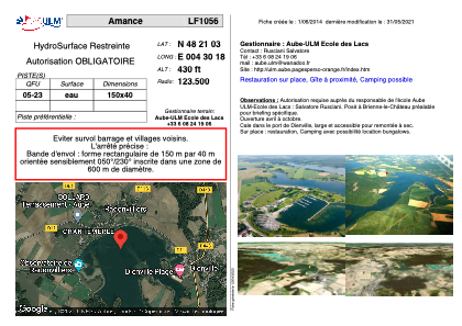


LF1056 - Amance
Located in Dienville, France
ICAO - , IATA -
Data provided by AirmateGeneral information
Coordinates: N48°21'3" E4°30'18"
Elevation is 430 feet MSL.
View others Airports in Champagne-Ardenne
Operational data
Special qualification required
Current time UTC:
Current local time:
Weather at : LFQB - Troyes Barberey ( 36 km )
METAR: LFQB 281100Z AUTO 22011KT CAVOK 14/06 Q1013
Communications frequencies: [VIEW]
Runways:
| RWY identifier | QFU | Length (ft) | Width (ft) | Surface | LDA (ft) |
| 05 | 0° | 492 | 131 | WATER | |
| 23 | 0° | 492 | 131 | WATER |
Airport contact information
Address: Dienville France