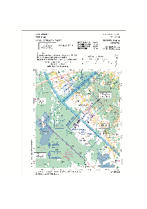
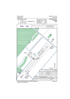


LDZR - Zagreb/Bratina
Located in Bratina, Croatia
ICAO - , IATA -
Data provided by AirmateGeneral information
Coordinates: N45°37'3" E15°47'41"
Elevation is 377 feet MSL.
Magnetic variation is 5° East View others Airports in Zagreb (city)
Operational data
Special qualification required
Current time UTC:
Current local time:
Weather at : LDZA - Zagreb / Franjo Tudjman ( 25 km )
METAR: LDZA 270730Z 22005KT 170V270 CAVOK 13/07 Q1016 TEMPO FM0800 22008KT
TAF: TAF LDZA 270525Z 2706/2806 VRB02KT CAVOK TX21/2713Z TN07/2804Z TEMPO 2709/2716 24009KT
Communications frequencies: [VIEW]
Runways:
| RWY identifier | QFU | Length (ft) | Width (ft) | Surface | LDA (ft) |
| 04 | 40° | 2596 | 99 | GRAS | 2297 |
| 22 | 220° | 2596 | 99 | GRAS | 2297 |
Airport contact information
Address: Bratina Croatia