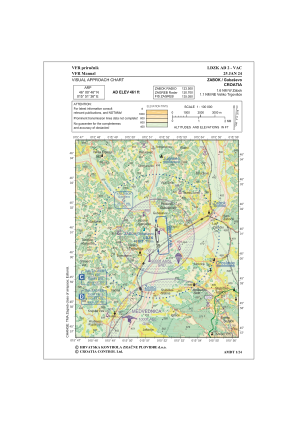
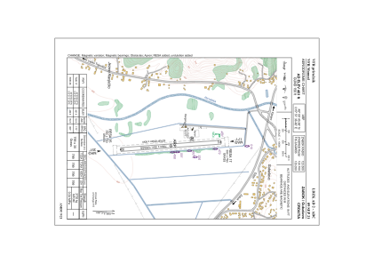


LDZK - Zabok/Gubasevo
Located in Guba, Croatia
ICAO - , IATA -
Data provided by AirmateGeneral information
Coordinates: N46°0'46" E15°51'36"
Elevation is 461 feet MSL.
Magnetic variation is 5° East View others Airports in Zagreb (city)
Operational data
Special qualification required
Current time UTC:
Current local time:
Weather at : LJCE - Cerklje Ob Krki ( 28 km )
METAR: LJCE 271200Z 20006KT 160V250 9999 FEW043 SCT065 19/08 Q1016 RMK BLU
TAF: TAF LJCE 271100Z 2712/2721 25008KT 9999 SCT040 PROB40 TEMPO 2712/2716 SHRA SCT035TCU BKN040
Communications frequencies: [VIEW]
Runways:
| RWY identifier | QFU | Length (ft) | Width (ft) | Surface | LDA (ft) |
| 17 | 175° | 2639 | 101 | GRAS | 2621 |
| 35 | 355° | 2639 | 101 | GRAS | 2621 |
Airport contact information
Address: Guba Croatia
