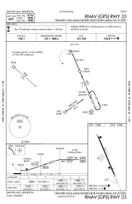


KGDB - Granite Falls Muni/Lenzen-Roe-Fagen Meml Fld
Located in Granite Falls, United States
ICAO - GDB, IATA -
Data provided by AirmateGeneral information
Coordinates: N44°45'9" W95°33'20"
Elevation is 1047 feet MSL.
Magnetic variation is 04° East View others Airports in Minnesota
Operational data
Special qualification required
Current time UTC:
Current local time:
Weather
METAR: KGDB 062055Z AUTO 12023G31KT 10SM BKN037 22/13 A2964 RMK AO2 T02190131
Communications frequencies: [VIEW]
Runways:
| RWY identifier | QFU | Length (ft) | Width (ft) | Surface | LDA (ft) |
| 15 | 157° | 4357 | 75 | ASPH | |
| 33 | 337° | 4357 | 75 | ASPH |
Airport contact information
Address: Granite Falls United States