


KBKE - Baker City Muni
Located in Baker City, United States
ICAO - BKE, IATA - BKE
Data provided by AirmateGeneral information
Coordinates: N44°50'14" W117°48'33"
Elevation is 3373 feet MSL.
Magnetic variation is 16° East View others Airports in Oregon
Operational data
Special qualification required
Current time UTC:
Current local time:
Weather
METAR: KBKE 021653Z AUTO 11009KT 10SM BKN041 OVC049 06/02 A2997 RMK AO2 RAB02E30 SLP160 P0000 T00560017
TAF: KBKE 021136Z 0212/0312 12005KT P6SM VCSH OVC040 FM021600 15007KT 5SM -SHRA BR OVC040 FM022200 34009KT P6SM VCSH BKN040 FM030500 30005KT P6SM BKN100
Communications frequencies: [VIEW]
Runways:
| RWY identifier | QFU | Length (ft) | Width (ft) | Surface | LDA (ft) |
| 08 | 97° | 3670 | 140 | ASPH | |
| 26 | 277° | 3670 | 140 | ASPH | |
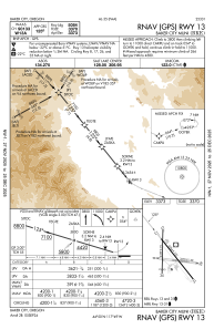
| 13 | 142° | 5085 | 100 | ASPH | |
| 31 | 322° | 5085 | 100 | ASPH | |
| 17 | 181° | 4359 | 75 | ASPH | |
| 35 | 1° | 4359 | 75 | ASPH |
Airport contact information
Address: Baker City United States
