


HLTD - Ghadames
Located in Ghadames, Libyan Arab Jamahiriya
ICAO - HLTD, IATA - LTD
Data provided by AirmateGeneral information
Coordinates: N30°9'6" E9°42'55"
Elevation is 1122 feet MSL.
Magnetic variation is 2° East View others Airports in Nalut District
Operational data
Special qualification required
Current time UTC:
Current local time:
Communications frequencies: [VIEW]
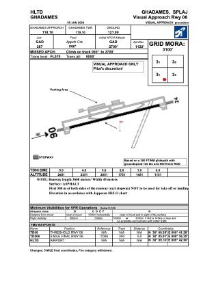
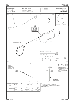
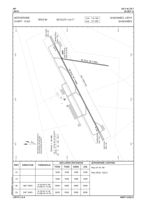
Runways:
| RWY identifier | QFU | Length (ft) | Width (ft) | Surface | LDA (ft) |
| 06 | 62° | 11808 | 131 | ASPH | |
| 24 | 242° | 11808 | 131 | ASPH |
Airport contact information
Address: Ghadames Libyan Arab Jamahiriya