


HLMS - Misrata International
Located in Misurata, Libyan Arab Jamahiriya
ICAO - , IATA - MRA
Data provided by AirmateGeneral information
Coordinates: N32°19'31" E15°3'39"
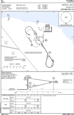
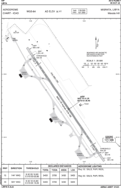
Elevation is 35 feet MSL.
Magnetic variation is 3° East View others Airports in Misurata District
Operational data
Special qualification required
Current time UTC:
Current local time:
Weather at : - ( 0 km )
METAR: MMMX 040135Z 06012KT 7SM TS BKN020 BKN080 OVC220 21/09 A3017 NOSIG RMK 8/463 HZY RAE35 PCPN 1ST 2ND QUAD
Communications frequencies: [VIEW]
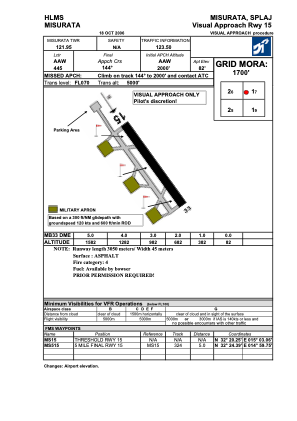
Runways:
| RWY identifier | QFU | Length (ft) | Width (ft) | Surface | LDA (ft) |
| 15 | 146° | 11117 | 144 | ASPH | |
| 33 | 326° | 11117 | 144 | ASPH |
Airport contact information
Address: Misurata Libyan Arab Jamahiriya