


H96 - Benton Muni
Located in Benton, United States
ICAO - H96, IATA -
Data provided by AirmateGeneral information
Coordinates: N38°0'31" W88°56'4"
Elevation is 444 feet MSL.
Magnetic variation is -02° East View others Airports in Illinois
Operational data
Special qualification required
Current time UTC:
Current local time:
Weather at : KMWA - Veterans Airport Of Southern Illinois ( 29 km )
METAR: KMWA 291445Z 15006KT 10SM OVC075 18/17 A2993
Communications frequencies: [VIEW]
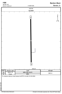
Runways:
| RWY identifier | QFU | Length (ft) | Width (ft) | Surface | LDA (ft) |
| 18 | 179° | 4002 | 75 | ASPH | |
| 36 | 359° | 4002 | 75 | ASPH |
Airport contact information
Address: Benton United States