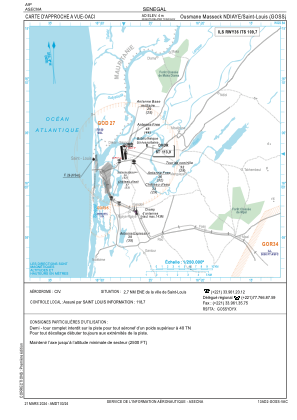
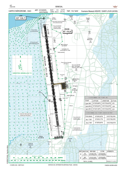


GOSS - Saint Louis
Located in Saint-Louis, Senegal
ICAO - GOSS, IATA - XLS
Data provided by AirmateGeneral information
Coordinates: N16°2'59" W16°27'40"
Elevation is 10 feet MSL.
Magnetic variation is -6° East View others Airports in Saint-Louis
Operational data
Special qualification required
Current time UTC:
Current local time:
Weather
METAR: GOSS 292000Z 36006KT 320V050 7000 NSC 29/15 Q1010
TAF: TAF GOSS 291700Z 2918/3018 36012KT 6000 NSC
Communications frequencies: [VIEW]
Runways:
| RWY identifier | QFU | Length (ft) | Width (ft) | Surface | LDA (ft) |
| 18 | 173° | 6234 | 98 | CONC | 6234 |
| 36 | 353° | 6234 | 98 | CONC | 6234 |
Airport contact information
Address: Saint-Louis Senegal