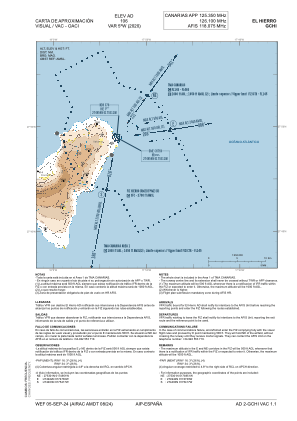
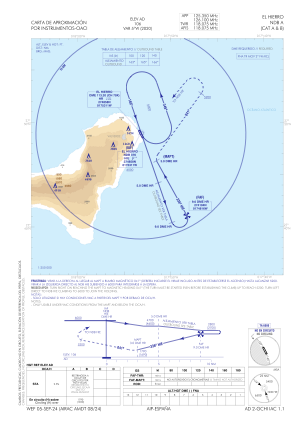


GCHI - El Hierro
Located in Hierro, Spain
ICAO - GCHI, IATA - VDE
Data provided by AirmateGeneral information
Coordinates: N27°48'53" W17°53'13"
Elevation is 104 feet MSL.
Magnetic variation is -5° East View others Airports in Canary Islands
Operational data
Special qualification required
Current time UTC:
Current local time:
Communications frequencies: [VIEW]
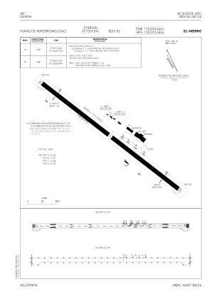
Runways:
| RWY identifier | QFU | Length (ft) | Width (ft) | Surface | LDA (ft) |
| 16 | 153° | 4101 | 98 | ASPH | 4101 |
| 34 | 333° | 4101 | 98 | ASPH | 4101 |
Airport contact information
Address: Hierro Spain