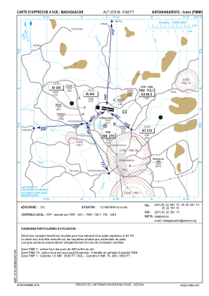
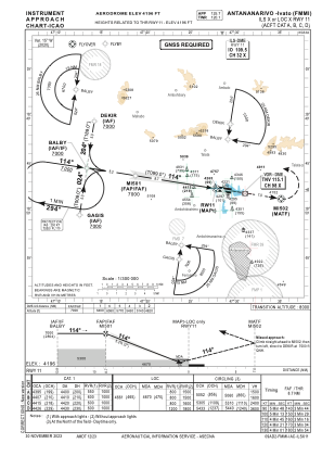
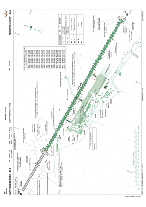


FMMI - Antananarivo/Ivato
Located in Antananarivo, Madagascar
ICAO - FMMI, IATA - TNR
Data provided by AirmateGeneral information
Coordinates: S18°47'47" E47°28'34"
Elevation is 4198 feet MSL.
View others Airports in Antananarivo
Operational data
Special qualification required
Current time UTC:
Current local time:
Weather
METAR: FMMI 291700Z 13006KT 100V180 9999 FEW017 BKN020 18/16 Q1023 NOSIG
TAF: TAF FMMI 291700Z 2918/3024 14012G25KT 9999 FEW007 BKN020 PROB30 TEMPO 3000/3004 4500 DZRA PROB30 TEMPO 3012/3018 4000 DZRA
Communications frequencies: [VIEW]
Runways:
| RWY identifier | QFU | Length (ft) | Width (ft) | Surface | LDA (ft) |
| 11 | 99° | 10171 | 148 | ASP | |
| 29 | 279° | 10171 | 148 | ASP |
Airport contact information
Address: Antananarivo Madagascar