


FHAW - Ascension Aux Af
Located in Georgetown, Saint Helena
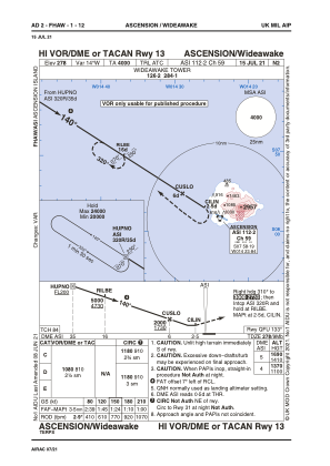
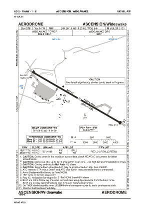
ICAO - FHAW, IATA - ASI
Data provided by AirmateGeneral information
Coordinates: S7°58'11" W14°23'37"
Elevation is 278 feet MSL.
View others Airports in Ascension
Operational data
Special qualification required
Current time UTC:
Current local time:
Communications frequencies: [VIEW]
Runways:
| RWY identifier | QFU | Length (ft) | Width (ft) | Surface | LDA (ft) |
| 13 | 117° | 10019 | 150 | ASPH | |
| 31 | 297° | 10019 | 150 | ASPH |
Airport contact information
Address: Georgetown Saint Helena