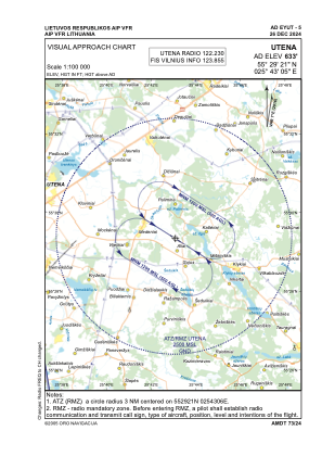
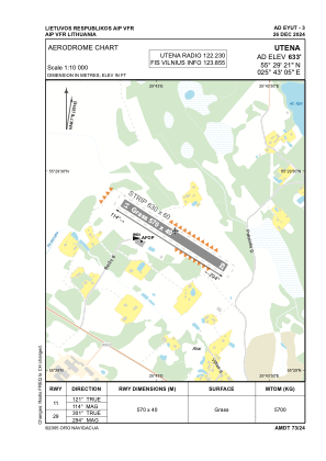


EYUT - Utena
Located in Utena, Lithuania
ICAO - EYUT, IATA -
Data provided by AirmateGeneral information
Coordinates: N55°29'21" E25°43'5"
Elevation is 633 feet MSL.
Magnetic variation is 7° East View others Airports in Utena County
Operational data
Special qualification required
Current time UTC:
Current local time:
Weather at : - ( 0 km )
METAR: KOTM 280038Z AUTO 36007KT 6SM RA BR OVC100 15/13 A2987 RMK AO2 LTG DSNT NE-S TSE32 PRESFR P0026 T01500133
Communications frequencies: [VIEW]
Runways:
| RWY identifier | QFU | Length (ft) | Width (ft) | Surface | LDA (ft) |
| 11 | 121° | 1870 | 131 | GRASS | |
| 29 | 301° | 1870 | 131 | GRASS |
Airport contact information
Address: Utena Lithuania