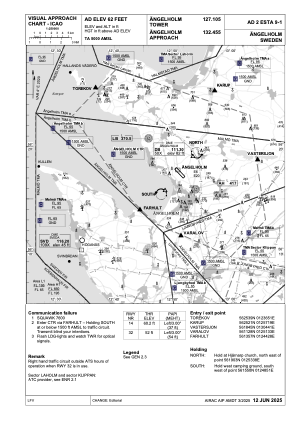


ESTA - Angelholm
Located in Angelholm, Sweden
ICAO - ESTA, IATA - AGH
Data provided by AirmateGeneral information
Coordinates: N56°17'28" E12°51'18"
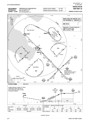
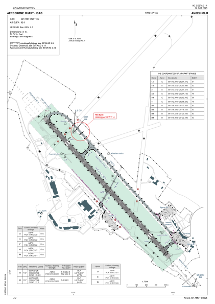
Elevation is 62 feet MSL.
Magnetic variation is +4.0° East View others Airports in Skåne län
Operational data
Special qualification required
Current time UTC:
Current local time:
Weather at : ESMT - Halmstad ( 44 km )
METAR: ESMT 071650Z 30013KT CAVOK 13/05 Q1023
TAF: TAF ESMT 071403Z 0715/0719 30010KT CAVOK BECMG 0718/0719 VRB02KT
Communications frequencies: [VIEW]
Runways:
| RWY identifier | QFU | Length (ft) | Width (ft) | Surface | LDA (ft) |
| 14 | 136° | 6381 | 148 | ASPH | 6381 |
| 32 | 316° | 6381 | 148 | ASPH | 6381 |
Airport contact information
Address: Angelholm Sweden
Web: www.aghairport.se
