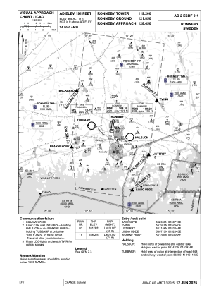

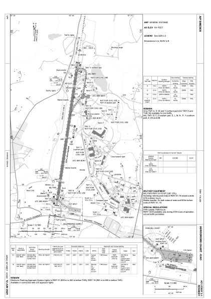


ESDF - Ronneby
Located in Ronneby, Sweden
ICAO - ESDF, IATA - RNB
Data provided by AirmateGeneral information
Coordinates: N56°15'60" E15°15'54"
Elevation is 191 feet MSL.
Magnetic variation is +5.0° East View others Airports in Blekinge län
Operational data
Special qualification required
Current time UTC:
Current local time:
Weather
METAR: ESDF 271950Z AUTO 11005KT 9999 NCD 06/03 Q1016
TAF: TAF ESDF 271130Z 2712/2714 22006KT CAVOK
Communications frequencies: [VIEW]
Runways:
| RWY identifier | QFU | Length (ft) | Width (ft) | Surface | LDA (ft) |
| 01 | 9° | 7648 | 148 | ASPH | 7648 |
| 19 | 189° | 7648 | 148 | ASPH | 7648 |
| 12 | 113° | 1969 | 98 | GRASS | 1969 |
| 30 | 293° | 1969 | 98 | GRASS | 1969 |
Airport contact information
Address: Ronneby Sweden
