


ENTY - Tynset (Airstrip)
Located in , Norway
ICAO - ENTY, IATA -
Data provided by AirmateGeneral information
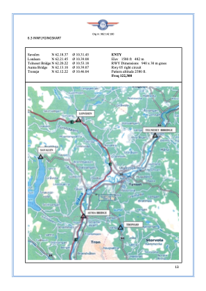
Coordinates: N62°15'26" E10°40'8"
Elevation is 1580 feet MSL.
Magnetic variation is 3.9° East View others Airports in Hedmark
Operational data
Special qualification required
Current time UTC:
Current local time:
Weather at : ENRO - Roeros ( 50 km )
METAR: ENRO 290750Z 11011KT 9999 VCSH SCT008 BKN015 03/01 Q1010
TAF: TAF ENRO 290500Z 2906/2915 14012KT 9999 BKN008 TEMPO 2906/2912 16015G25KT BKN015 BECMG 2910/2912 20008KT BKN020
Communications frequencies: [VIEW]
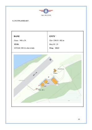
Runways:
| RWY identifier | QFU | Length (ft) | Width (ft) | Surface | LDA (ft) |
| 05 | 0° | 3084 | 98 | Grass | |
| 23 | 0° | 3084 | 98 | Grass |
Airport contact information
Address: Norway
