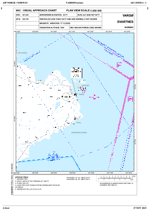
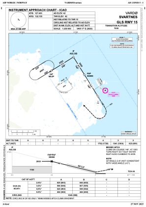
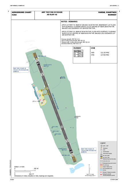


ENSS - Svartnes
Located in Vardoe, Norway
ICAO - ENSS, IATA - VAW
Data provided by AirmateGeneral information
Coordinates: N70°21'19" E31°2'42"
Elevation is 42 feet MSL.
Magnetic variation is 16.5° East View others Airports in Finnmark
Operational data
Special qualification required
Current time UTC:
Current local time:
Weather
METAR: ENSS 060620Z 03008KT 9999 -SHSN FEW004 SCT014 BKN020 M01/M03 Q1015 RMK WIND 0500FT VRB07G20KT
TAF: TAF ENSS 060500Z 0606/0615 03009KT 9999 FEW015CB TEMPO 0606/0615 1200 SHSN VV007
Communications frequencies: [VIEW]
Runways:
| RWY identifier | QFU | Length (ft) | Width (ft) | Surface | LDA (ft) |
| 15 | 163° | 3760 | 98 | ASP | |
| 33 | 343° | 3760 | 98 | ASP |
Airport contact information
Address: Vardoe Norway