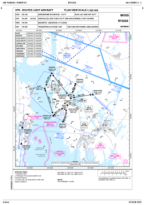
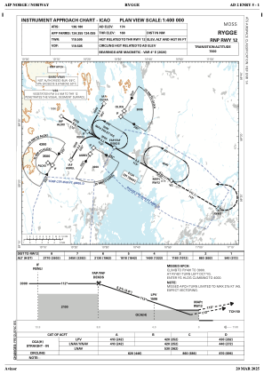
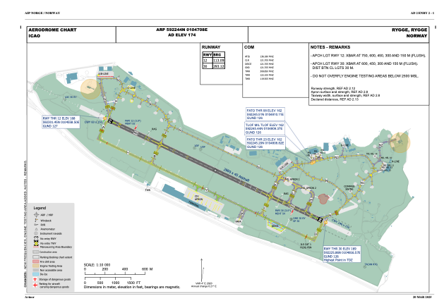


ENRY - Rygge
Located in Rygge, Norway
ICAO - ENRY, IATA - RYG
Data provided by AirmateGeneral information
Coordinates: N59°22'44" E10°47'8"
Elevation is 173 feet MSL.
Magnetic variation is 3.7° East View others Airports in Østfold
Operational data
Special qualification required
Current time UTC:
Current local time:
Weather
METAR: ENRY 281950Z AUTO 36007KT 9999 UP SCT014/// BKN110/// 08/06 Q1013
TAF: TAF ENRY 281700Z 2818/2918 04008KT 9999 BKN012 TEMPO 2818/2820 BKN008 TEMPO 2820/2903 2500 SHRA BR BKN003 SCT030CB BECMG 2901/2903 22015KT TEMPO 2903/2918 22018G28KT TEMPO 2903/2912 BKN008 BECMG 2912/2914 FEW012
Communications frequencies: [VIEW]
Runways:
| RWY identifier | QFU | Length (ft) | Width (ft) | Surface | LDA (ft) |
| 12 | 117° | 8012 | 148 | ASP | |
| 30 | 297° | 8012 | 148 | ASP |
Airport contact information
Address: Rygge Norway
