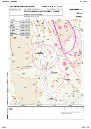
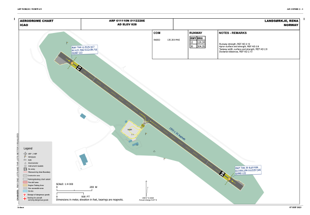


ENRE - Rena
Located in Landsoerkje, Norway
ICAO - , IATA -
Data provided by AirmateGeneral information
Coordinates: N61°11'10" E11°22'28"
Elevation is 828 feet MSL.
Magnetic variation is 4.1° East View others Airports in Hedmark
Operational data
Special qualification required
Current time UTC:
Current local time:
Weather at : ESKS - Salen/Scandinavian Mountains ( 78 km )
METAR: ESKS 291320Z AUTO 22010KT 180V250 9999 FEW007/// BKN010/// OVC018/// 07/06 Q1015
Communications frequencies: [VIEW]
Runways:
| RWY identifier | QFU | Length (ft) | Width (ft) | Surface | LDA (ft) |
| 12 | 129° | 4265 | 97 | ASPH | 3281 |
| 30 | 309° | 4265 | 97 | ASPH | 3281 |
Airport contact information
Address: Landsoerkje Norway