


ENKJ - Kjeller
Located in Lillestrom, Norway
ICAO - ENKJ, IATA -
Data provided by AirmateGeneral information
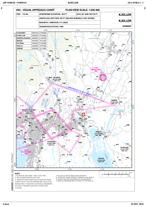
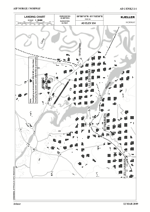
Coordinates: N59°58'10" E11°2'20"
Elevation is 354 feet MSL.
Magnetic variation is 3.9° East View others Airports in Akershus
Operational data
Special qualification required
Current time UTC:
Current local time:
Weather at : ENGM - Gardermoen ( 26 km )
METAR: ENGM 291220Z 22013KT 9999 VCSH SCT030 BKN038 11/03 Q1016 TEMPO SHRA FEW020CB BKN030
TAF: TAF ENGM 291100Z 2912/3012 22012KT 9999 SCT015 BKN025 TEMPO 2912/2914 SHRA FEW020CB PROB40 2923/3006 0500 FG VV002 PROB40 3006/3010 BKN008
Communications frequencies: [VIEW]
Runways:
| RWY identifier | QFU | Length (ft) | Width (ft) | Surface | LDA (ft) |
| 12 | 123° | 4429 | 98 | ASP | |
| 30 | 303° | 4429 | 98 | ASP |
Airport contact information
Address: Lillestrom Norway

