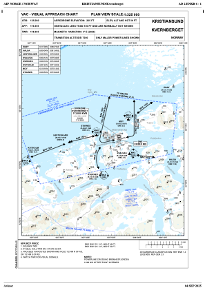
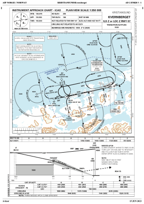
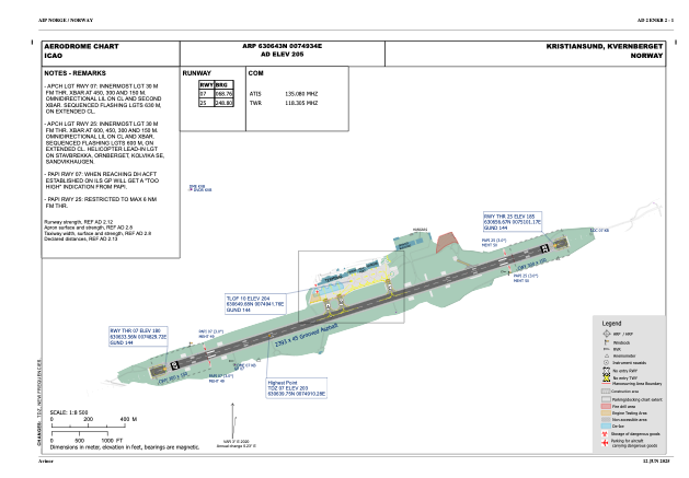


ENKB - Kvernberget
Located in Kristiansund, Norway
ICAO - ENKB, IATA - KSU
Data provided by AirmateGeneral information
Coordinates: N63°6'43" E7°49'34"
Elevation is 204 feet MSL.
Magnetic variation is 2.6° East View others Airports in Møre og Romsdal
Operational data
Special qualification required
Current time UTC:
Current local time:
Weather
METAR: ENKB 051350Z 01012KT CAVOK 15/03 Q1007 RMK WIND 745FT 03019KT
TAF: TAF ENKB 051100Z 0512/0521 01008KT CAVOK TEMPO 0513/0517 02018KT
Communications frequencies: [VIEW]
Runways:
| RWY identifier | QFU | Length (ft) | Width (ft) | Surface | LDA (ft) |
| 07 | 72° | 7851 | 148 | ASP | |
| 25 | 252° | 7851 | 148 | ASP |
Airport contact information
Address: Kristiansund Norway