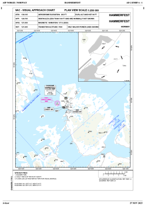
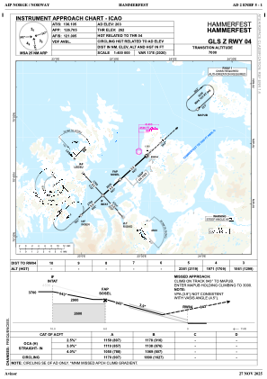
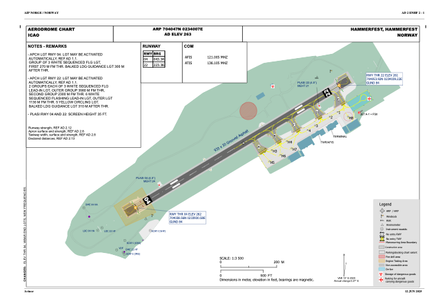


ENHF - Hammerfest
Located in Hammerfest, Norway
ICAO - ENHF, IATA - HFT
Data provided by AirmateGeneral information
Coordinates: N70°40'47" E23°40'7"
Elevation is 262 feet MSL.
Magnetic variation is 12.6° East View others Airports in Finnmark
Operational data
Special qualification required
Current time UTC:
Current local time:
Weather
METAR: ENHF 052120Z 03009KT 9999 -SHSN FEW012 SCT016 BKN028 M02/M04 Q1019 RMK WIND 1254FT 01015KT
TAF: TAF ENHF 052000Z 0521/0606 36008KT 9999 -SHSN FEW015TCU BKN030 PROB40 TEMPO 0521/0603 2500 -SHSN VV008
Communications frequencies: [VIEW]
Runways:
| RWY identifier | QFU | Length (ft) | Width (ft) | Surface | LDA (ft) |
| 04 | 0° | 3061 | 98 | UNK | |
| 22 | 0° | 3061 | 98 | UNK |
Airport contact information
Address: Hammerfest Norway