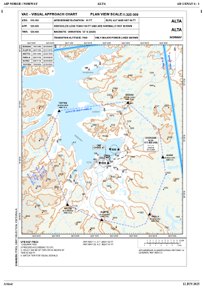
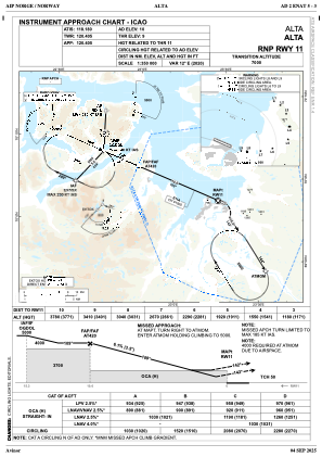
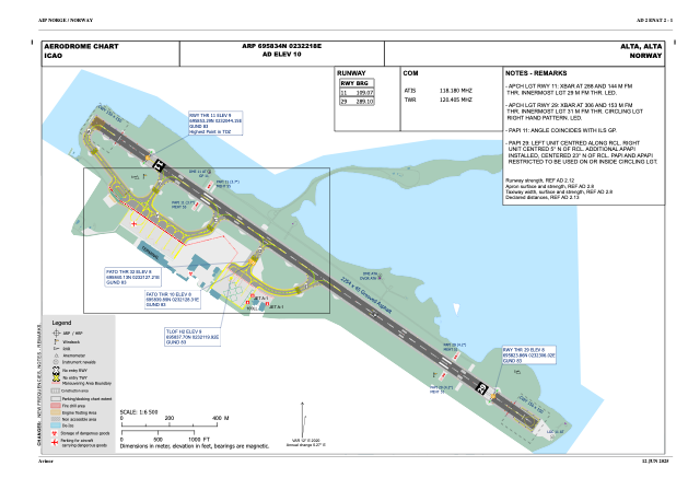


ENAT - Alta
Located in Alta, Norway
ICAO - ENAT, IATA - ALF
Data provided by AirmateGeneral information
Coordinates: N69°58'34" E23°22'18"
Elevation is 10 feet MSL.
Magnetic variation is 12.1° East View others Airports in Finnmark
Operational data
Special qualification required
Current time UTC:
Current local time:
Weather
METAR: ENAT 052320Z AUTO 36008KT 9999 OVC030/// 00/M05 Q1020 RMK WIND 700FT 01011KT
TAF: TAF ENAT 051400Z 0515/0522 33012KT 9999 FEW025 BKN035
Communications frequencies: [VIEW]
Runways:
| RWY identifier | QFU | Length (ft) | Width (ft) | Surface | LDA (ft) |
| 11 | 121° | 7395 | 148 | ASP | |
| 29 | 301° | 7395 | 148 | ASP |
Airport contact information
Address: Alta Norway