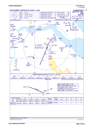
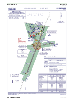


EGNJ - Humberside
Located in Hull, United Kingdom
ICAO - EGNJ, IATA - HUY
Data provided by AirmateGeneral information
Coordinates: N53°34'24" W0°21'5"
Elevation is 121 feet MSL.
View others Airports in England
Operational data
Special qualification required
Current time UTC:
Current local time:
Communications frequencies: [VIEW]
Runways:
| RWY identifier | QFU | Length (ft) | Width (ft) | Surface | LDA (ft) |
| 02 | 22° | 7205 | 148 | UNK | |
| 20 | 202° | 7205 | 148 | UNK | |
| 08 | 82° | 3245 | 59 | UNK | |
| 26 | 262° | 3245 | 59 | UNK |
Airport contact information
Address: Hull United Kingdom

