
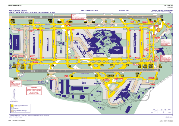


EGLL - London Heathrow
Located in London, United Kingdom
ICAO - EGLL, IATA - LHR
Data provided by AirmateGeneral information
Coordinates: N51°28'39" W0°27'41"
Elevation is 83 feet MSL.
View others Airports in England
Operational data
Special qualification required
Current time UTC:
Current local time:
Weather
METAR: EGLL 290720Z AUTO 19011KT 170V240 9999 NCD 11/07 Q1015 NOSIG
TAF: TAF EGLL 290454Z 2906/3012 21012KT 9999 FEW045 PROB40 TEMPO 2910/2918 19015G25KT BECMG 2918/2921 15010KT
Communications frequencies: [VIEW]
Runways:
| RWY identifier | QFU | Length (ft) | Width (ft) | Surface | LDA (ft) |
| 09L | 90° | 12799 | 164 | ASP | |
| 27R | 270° | 12799 | 164 | ASP | |
| 09R | 90° | 12001 | 164 | ASP | |
| 27L | 270° | 12001 | 164 | ASP |
Airport contact information
Address: London United Kingdom
